Satellite Remote Sensing
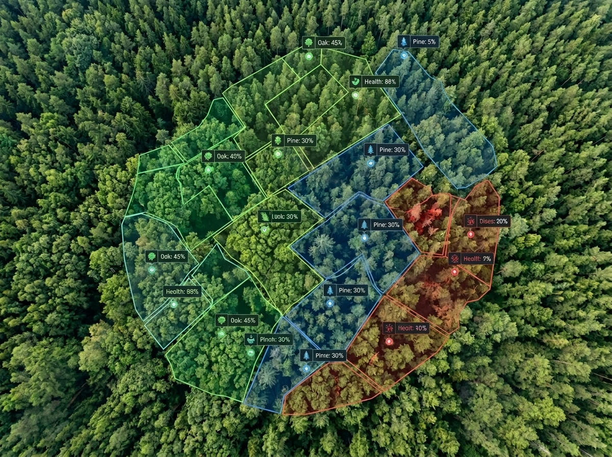
Multi-spectral imagery aids forest health assessment.
Forests are crucial for climate stability and biodiversity, but monitoring them has been challenging. Mynzo uses precision AI and satellite intelligence to provide real-time insights into global ecosystems.
Satellite Remote Sensing
Multi-spectral imagery aids forest health assessment.
Machine Learning Models
Deep learning detects deforestation with 98.5% accuracy.
Carbon Sequestration Analysis
Algorithms convert forest data into carbon metrics.
Temporal Insights
Analyze ecosystem shifts, disturbances, and long-term environmental changes across time.
A unified system to analyze, control, and manage nature assets
Asset Analysis
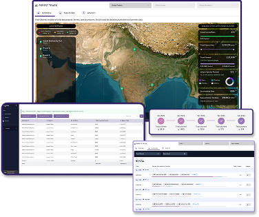
Asset Control
Asset Management
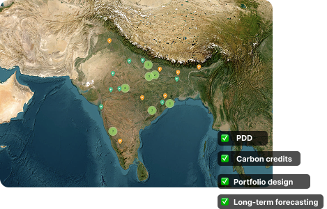
A rigorous, transparent pipeline that turns raw forest data into auditable carbon credits.
Every data point is traceable, defensible, and ready for third-party review.
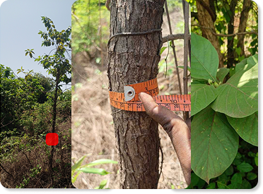
Tree-level and species-level insights delivered at scale across your entire portfolio.
Reduce reliance on ground teams and drones while improving data quality and coverage.
Seamless integration into existing MIS, ERP, and reporting systems.
Manage net-zero portfolios with full visibility and control
Monitor, verify, and scale nature-based projects
Track biodiversity and carbon across large ecosystems

Reni processes live satellite feeds, ground sensor data, and Mynzo's proprietary models to deliver audit-ready intelligence — in seconds.
Passionate experts combining cutting-edge technology with deep environmental knowledge.


Schedule a demo to see how mynzo revolutionizes forest intelligence.
Get Started